Features
'Like a breath of fresh air!'
Pebble Geo is focused on the essential work you need to get done. It's not loaded up with features you'll never use. This makes it intuitive, nimble, and effortlessly powerful.

Logs and Sections
Log templates are pre-configured to work out of the box with no fiddly configuration required. Pebble Geo will auto-select the appropriate layout for the hole type.
Control print options, add a draft watermark, checker / approver, add trial pit photos, include hole construction data tables.
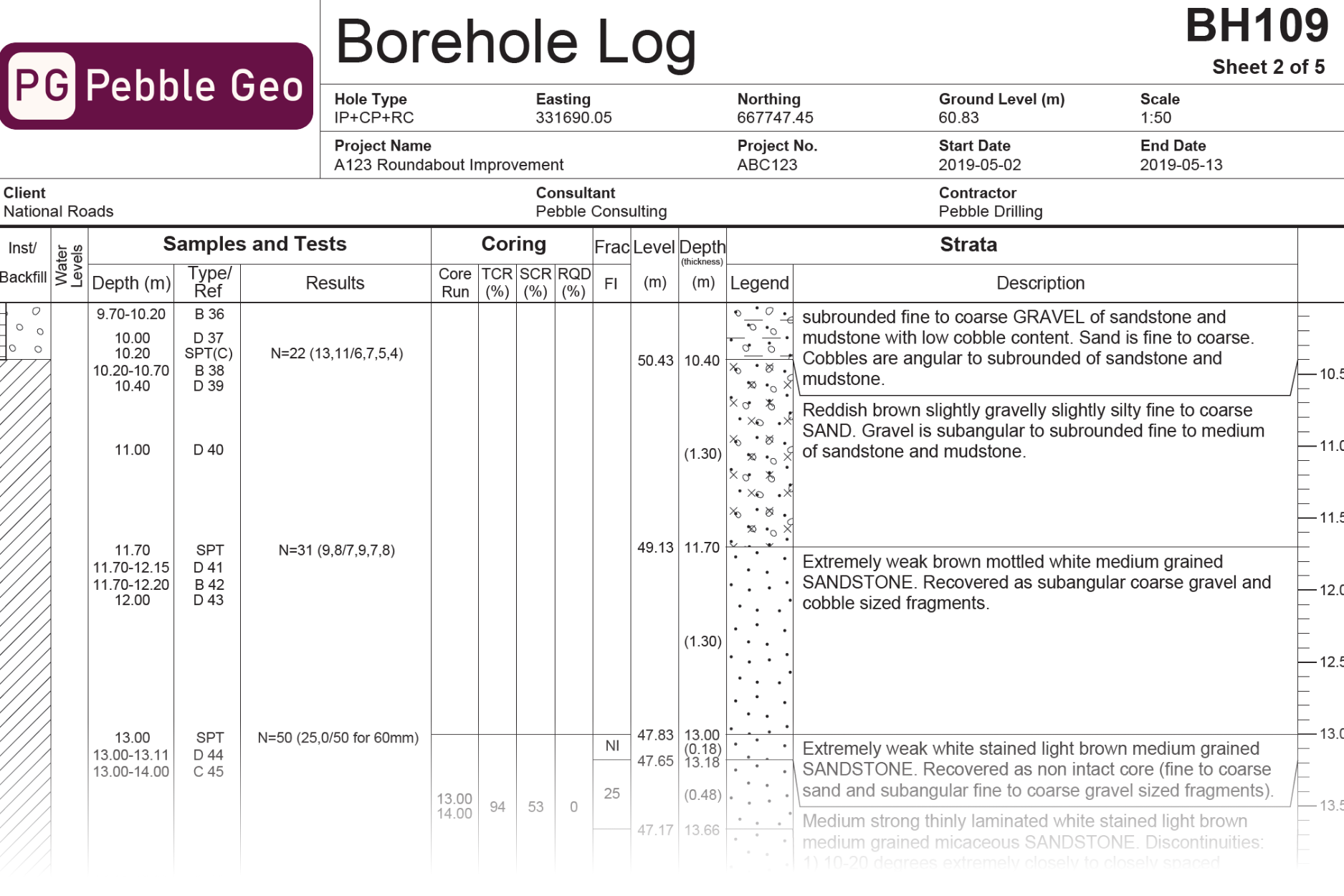
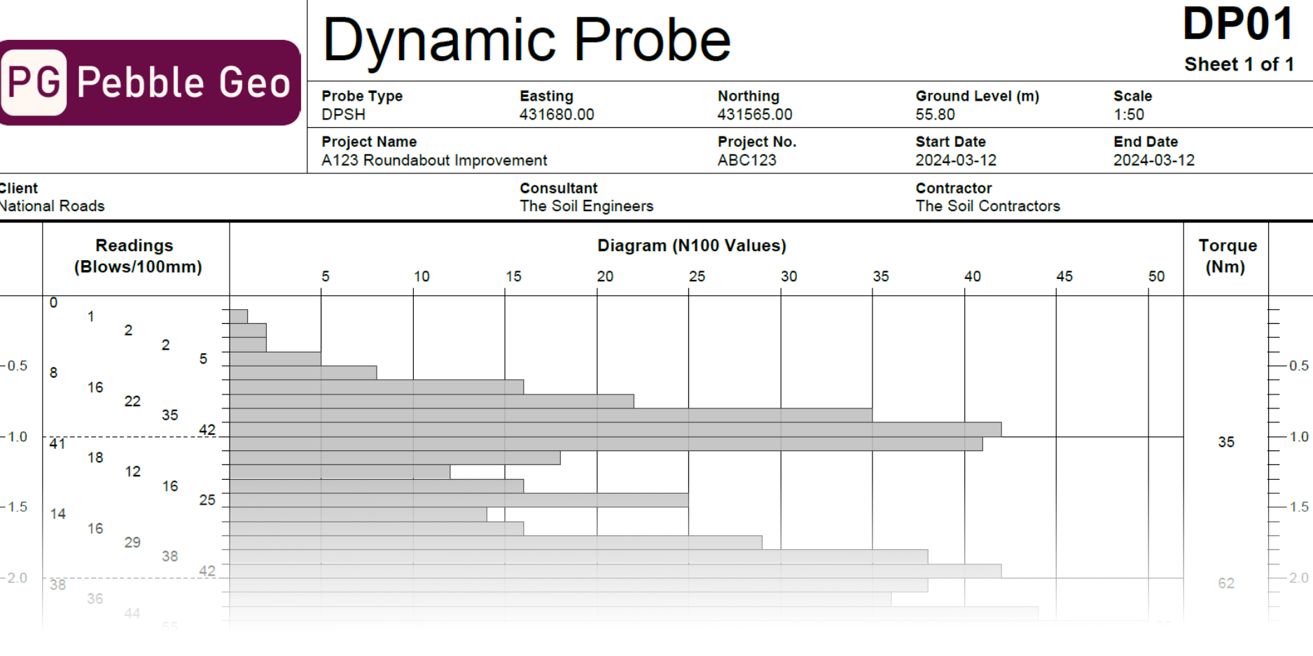
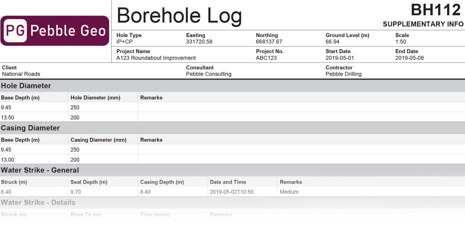
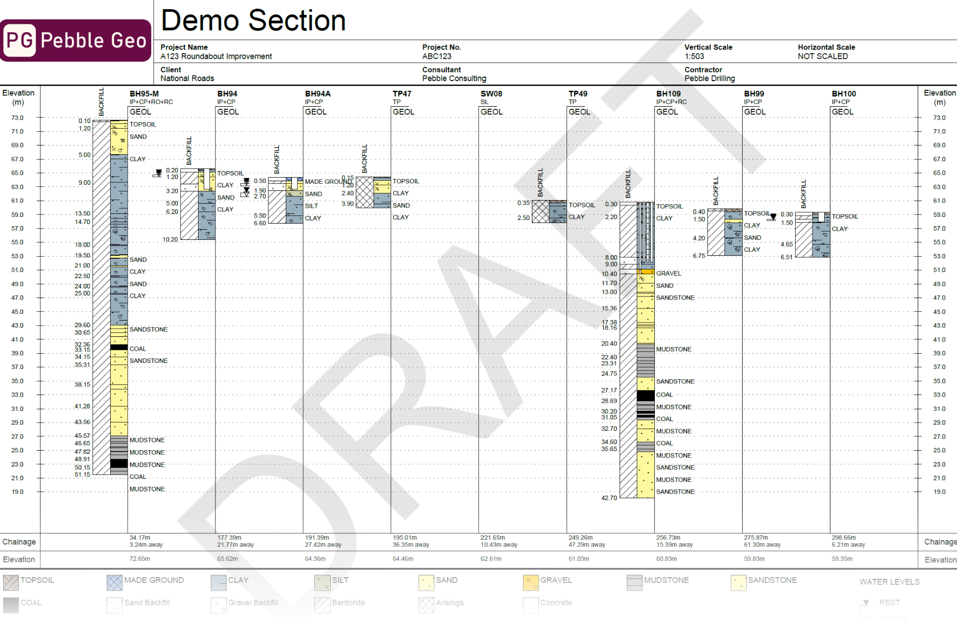
Borehole Logging
Data entry / borehole logging in Pebble Geo is handled using a custom-designed Excel workbook. Enter data into the Excel workbook, save it, then drag into Pebble Geo (or upload to the web app), and click Print!
By the way, you're welcome to make and distribute copies of the Excel workbooks as you wish, so you can send them to contractors to use for example.
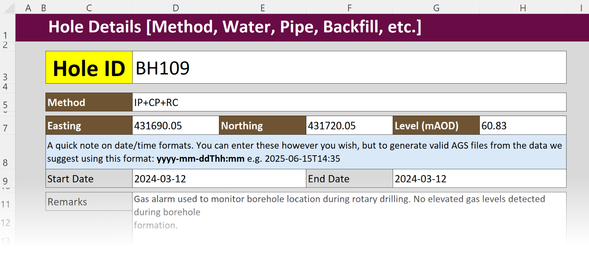
Workbook 1: Single Hole
This version of the workbook is set up for easy entry of data for a single hole. It's optimised for use on smaller screens, making it ideal for use on a small laptop or tablet.
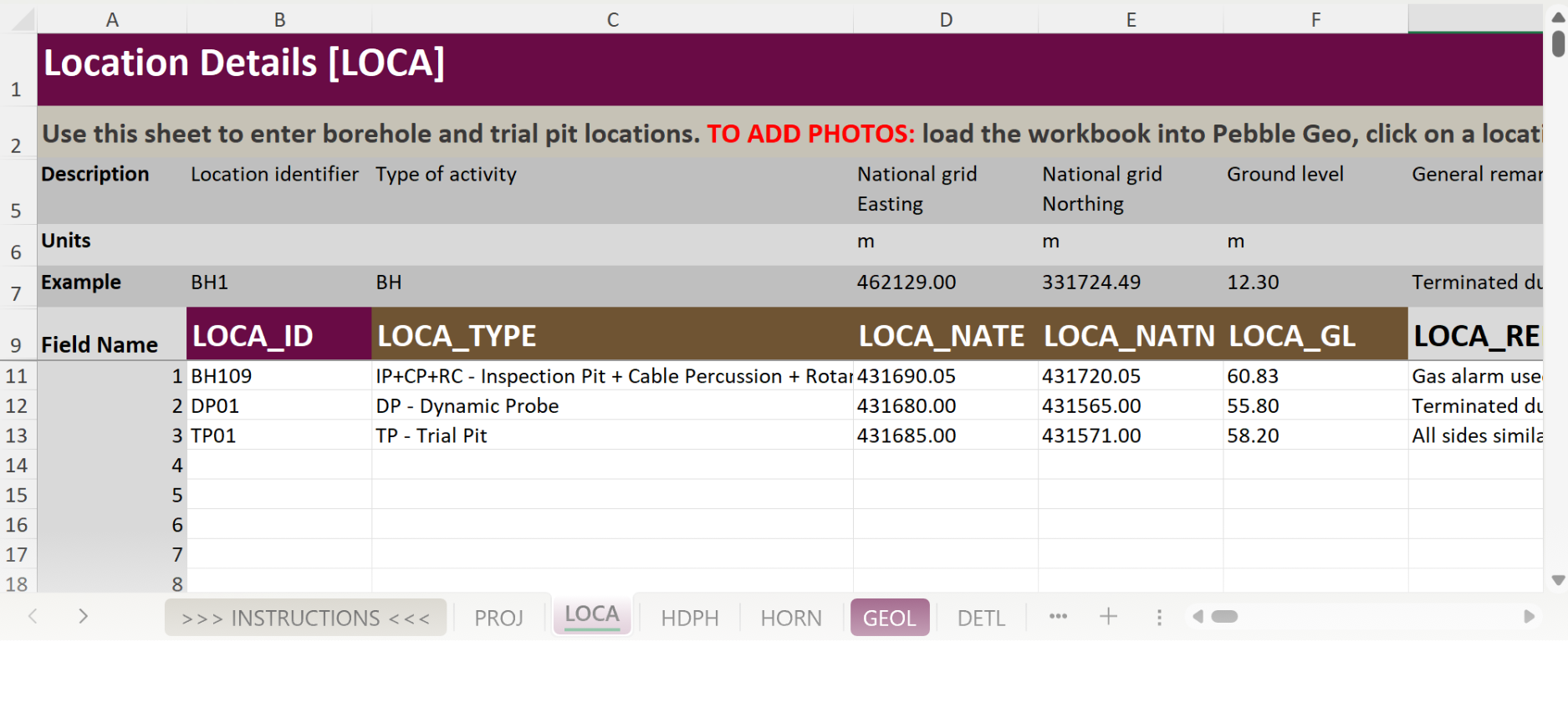
Workbook 2: Whole Project
This version of the workbook is set up for easy entry of data for an entire project. You enter data for all of the holes on the site into the one workbook. This is ideal for office-based use when you want to keep all your data in one file.
Desktop and Web
All Pebble Geo users get access to both Desktop and Web apps.
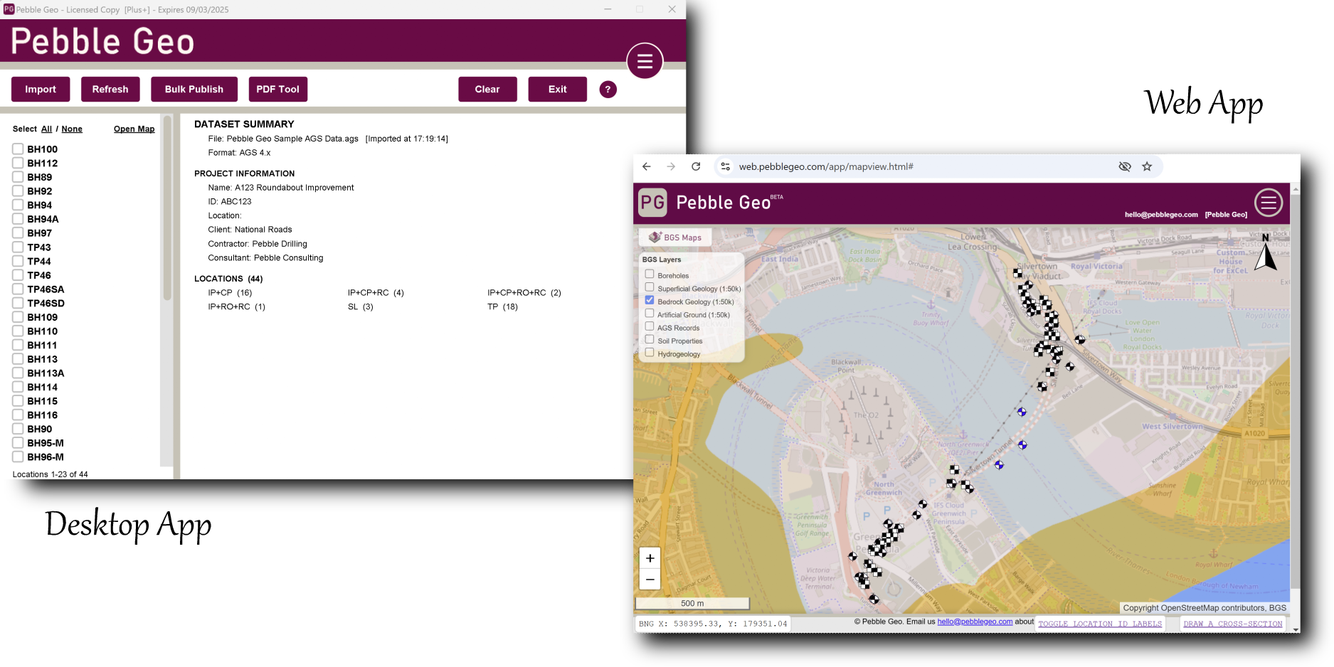
The desktop app is a small Windows app that you can download and install. It is activated using a license key.
The web app is a version of Pebble Geo that runs in your web browser. Each user will have a login for the web app. You can go to the web app now.
One advantage of the web app is the map interface, which lets you plot your holes against a global streetmap and satellite imagery, plus other layers such as BGS geology mapping and historic maps for GB users.
Summary Reports and Plots
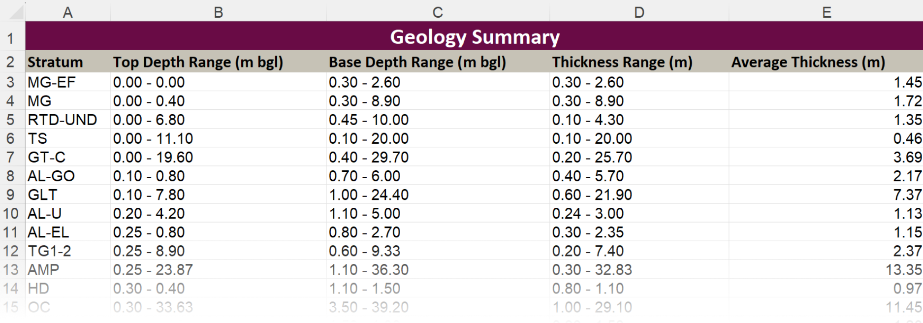
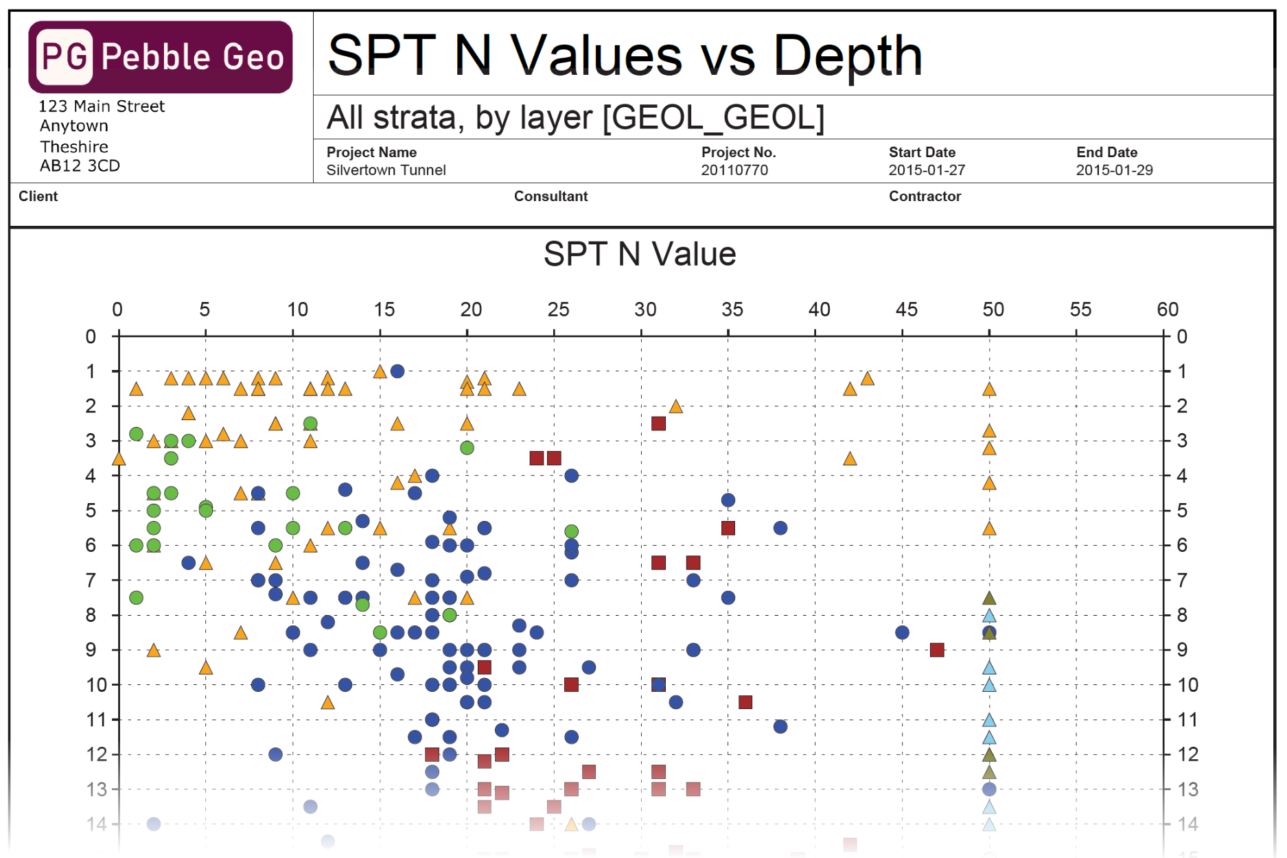
The one-click summary reporting function helps with your ground / site investigation report compilation. This tool outputs both PDF depth plots for in-situ test results, and also generates a handy Excel workbook with tabular summaries of locations, geology, water levels and SPTs - all ready to drop into your reports! Included in all versions of Pebble Geo.
Data Tools and Formats
Data tools and format support depends on the product level. For more info on product levels see the pricing page.
Pebble Geo Standard
- ✔ Import Pebble Geo Excel workbooks
- ✔ Import AGS
- ✔ Export CSV
Pebble Geo Plus+
As Standard, plus...
- ✔ Generate AGS files
- ✔ Merge AGS files into project (e.g. lab test results)
- ✔ Re-Import CSV
- ✔ Export geotechnical lab schedules